
Magnetic Field Model MF4
|
MF4 is a field model representing the visible part of the crustal magnetic field. It is derived from almost 5 years of CHAMP measurements of the period 09-Aug-2000 to Apr-2005. The model is given as a spherical harmonic expansion of the scalar magnetic potential to degree 90. Coefficients 1-15 are set to zero, since these coefficients are masked by the main magnetic field with its source in the Earth's core.
See also the special model for ground level: MF4x Improvements over MF3 (GFZ)
Data processing scheme for the MF4 model |
||||||||||
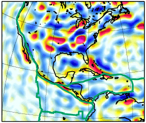


| Available MF4 Downloads | ||||||
|---|---|---|---|---|---|---|
| Type | Format | Mbyte | Ref.Radius | Contents | ||
| SH coefficients | ASCII Table | 0.2 | 6371.2 km | MF4 Model spherical harmonic coefficients (Schmid semi-normalized, as usual) | ||
| |
Graphic | 0.5 | 6771.2 km | Image of Bz at average satellite altitude | ||
| |
Graphic | 0.8 | 6429.2 km | Image of Bz at 50 km above surface | ||
| |
Graphic | 0.7 | 6771.2 km | Image of total intensity anomaly (dT) at 400 km altitude | ||
| |
Graphic | 0.7 | 6429.2 km | Image of total intensity anomaly (dT) at 50 km above surface | ||
| |
Graphic | 0.6 | 6471.2 km | Image of analytic signal |grad(dT)| at 100 km altitude | ||
| |
Graphic | 0.6 | 6771.2 km | Image of analytic signal |grad(dT)| at 400 km altitude | ||
| |
Data grid | ASCII Listing | 20 | 6771.2 km | 15' grid of Bz at average satellite altitude | |
| |
Data grid | ASCII Listing | 20 | 6771.2 km | Total intensity anomaly (dT) at 400 km altitude | |
| |
Data grid | ASCII Listing | 20 | 6429.2 km | Total intensity anomaly (dT) at 50 km above surface | |
| |
Data grid | ASCII Listing | 21 | 6471.2 km | Analytic signal |grad(dT)| at 100 km altitude | |
| |
Data grid | ASCII Listing | 22 | 6471.2 km | Northward derivative of dT at 100 km altitude | |
| |
Data grid | ASCII Listing | 22 | 6471.2 km | Eastward derivative of dT at 100 km altitude | |
| |
Data grid | ASCII Listing | 22 | 6471.2 km | Downward derivative of dT at 100 km altitude | |
| |
Data grid | ASCII Listing | 20 | 6429.2 km | 15' grid of Bz at 50 km above surface | |
| |
Animation | AVI | 31 | 6471.2 km | Simple animation of a rotating sphere with MF4 crustal anomalies using Z at 100 km altitude, exaggerated as 3D and colored; the smaller greyish structures are only bumpmap overlays of a topographic/bathymetric map. Runs in MS Powerpoint und Apple Quicktime 5.0.2, but not in MS Windows Media Player. Compression yields in a loss of image quality. |
|
| = use with caution since noise is strongly amplified by downward continuation! | ||||||
Stefan Maus, Martin Rother.
Last modified: Wednesday, 27-Jun-2007 19:01:52 MDT