• Core Cut

    Click the image to learn more about the Earth's magnetic field!

  • WMM2020 Released

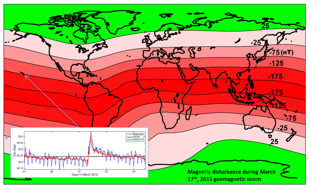
    The latest World Magnetic Model (WMM2020) was released December 10, 2019. 

    The World Magnetic Model is the standard model for navigation, attitude and heading referencing systems using the geomagnetic field. The model, associated software, and documentation are distributed by NCEI on behalf of NGA. The model is produced at 5-year intervals, with the current model expiring on December 31, 2024.

  • Geomagnetism Story Map

    The CIRES geomagnetism team worked with the NCEI story map team to create an ArcGIS story map that takes users through all of the components of the Earth's magnetic field. Learn more about the magnetic field HERE

  • Geomagnetism XKCD

    The Earth's magnetic field changes over time, sometimes in ways we do not expect when we compile and release the model. That is why the geomagnetism team is updating the World Magnetic Model, so users can continue to navigate safely without noticing any performance issues. Credit XKCD

  • Crowdmag

    Use your phone as a magnetic sensor! Here is an opportunity for you to be a part of our research on the geomagnetic field. Install CrowdMag app and share your magnetic data. You can also view maps and graphs shared by other citizen scientists.

  • HDGM-RT

    The Real-Time add-on to the High Definition Geomagnetic Model (HDGM-RT) includes a model of Earth's magnetosphere which provides near real-time estimates of the external disturbance field due to the solar wind.  More Information

Please enter the email address for your account. A verification code will be sent to you. Once you have received the verification code, you will be able to choose a new password for your account.