B.A., Geophysics, University of Colorado
David Skaggs Research Center
RESEARCH INTERESTS
My research interests are in the use of marine and airborne remote sensing techniques to measure magnetic anomalies created by the distribution of magnetic minerals within the Earth's lithosphere. To that end, I reformat, quality control, ingest, and archive marine and airborne magnetic and gravity surveys run by academic, commercial, and government institutions into a central database hosted at the National Centers for Environmental Information (NCEI).
CURRENT RESEARCH
My group works with space-based, airborne, marine and in-situ magnetic field observatories to study changes in Earth’s magnetic field, on a minute, hourly, daily, and yearly time frame. The primary application of this research is to improve navigation accuracy for land, sea, and airborne modes of transportation, satellite orientation, and to explore natural resources.
The Earth's lithosphere contains a non-uniform distribution of magnetic minerals of varying strength. Some minerals re-enforce the Earth's magnetic field, making it strong in areas, and others do not interact with the field, making it weaker. These are characterized as magnetic anomalies. These anomalies can locally deflect magnetic navigation methods (e.g. a compass) to point away from geographic north. These deflections, called declination, can be important for navigating on Earth's surface, in the air, underground, and under water.
Lithosphere magnetization can also be used to characterize the development of Earth's plate motion and age. As rocks cool below what is called the Curie temperature, a rock along a spreading ridge will "lock in" the direction of the current magnetic field. Over millions of years the magnetic field of the Earth will switch polarity from its current state. These magnetic reversals are seen as parallel bands along the ocean floor. These bands show earth scientists how the spreading ridges behave over time and give us many other insights into Earth's geologic history.
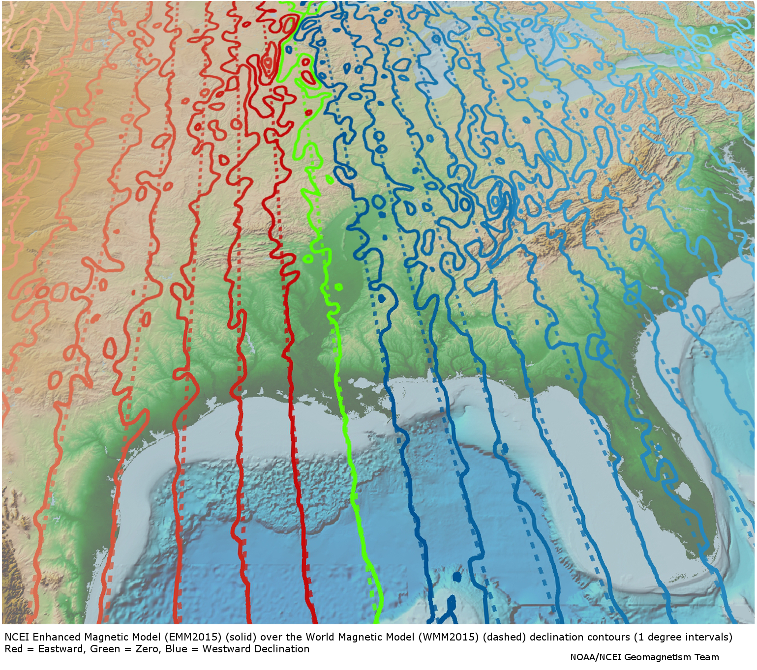
Currently, I am working on an update to the Earth Magnetic Anomaly Grid 2 arc-minute resolution (EMAG2). This is a high definition map of the strength of the anomalous areas across the globe. This map can be combined with the Geomagnetism Team's World Magnetic Model (WMM2015) to provide a more accurate model of how the Earth's magnetic field behaves locally. This models is called the Enhanced Magnetic Field Model (EMM2015). The differences between the models are pictured on the right.
HONORS AND AWARDS
- CIRES Outstanding Performance Award 2014
- CIRES Outstanding Performance Award 2019
- COLABS Governors Award for Excellence in Fundamental Science and Technology
- Member of the International Association of Geomagnetism and Aeronomy (IAGA) World Digital Magnetic Anomaly Map (WDMAM) Task Force and Evaluators
- Member of American Geophysical Union (AGU)

Magnetic Trackline data collected over the past 50 years (1965-2015). Data managed by Brian Meyer

